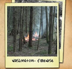
Columbia County Emergency Management hosted their first annual Capability Assessment Workshop on Tuesday, May 25th, 2010 at the Seneca activity building in Dayton.
Darrell Ruby, Region 9 Coordinator for Homeland Security was the facilitator for the workshop.
Preparedness is everyone's responsibility. Knowledgeable, empowered individuals and communities can make choices that minimize the impact of emergencies and disasters. Local governments educate and prepare communities, mitigate risks, and provide first response and recovery assistance. Voluntary organizations and businesses aid these efforts. Regional partner governments and communities augment local resources when necessary. Because major events can exceed the normal operating capacity of any single discipline, a collaborative, multi-discipline approach is needed to plan and prepare for major events.
The assessment was the first step in the annual preparedness cycle: assess capabilities, identify gaps and priorities, update strategic and multi-year plans, invest to fill gaps, and reassess capabilities.
The information gathered at the workshop will be compiled and shared with Region 9 Homeland Security Counties (Adams, Asotin, Columbia, Ferry, Garfield, Lincoln, Pend Oreille, Spokane, Stevens, Whitman and the Kalispell and Spokane Tribes). This information will serve as a guide for identifying and prioritizing investments when working to establish a capability. It will also help implement appropriate hazard mitigation strategies, and prepare for hazards and emergencies individual counties cannot mitigate on their own in order to have an effective response and recovery system in place.
In attendance were a well rounded group of multi-discipline stakeholders from throughout the County. Such stakeholders included, Columbia County Extension Agent, Columbia REA, Puget Sound Energy, Chamber of Commerce, Columbia County Fire District 1 and 3, Columbia County EMS, Columbia County Sheriff's Office and Communications, Blue Mountain chapter of the Red Cross, Columbia County Engineer and Public Works, Columbia County Transportation, Columbia County Public Health, Washington Department of Transportation and Mayor's from the City of Dayton and the Town of Starbuck.
The information provided to us from this group was invaluable. They are an integral resource to Emergency Management and Columbia County as a whole. When you see someone from any of the entities mentioned above tell them thank you for participating in making our community a safer place to live.
Thursday, May 27, 2010
Safe Memorial Day Weekend
MAP Release
(Multi-Agency Partnership)
***For Immediate Release***
Date: May 27, 2010
(Multi-Agency Partnership)
***For Immediate Release***
Date: May 27, 2010
Idaho State Police
Captain Clark Rollins or
Lieutenant Chris Schenck
Phone: (208) 772-6055
Washington State Patrol
Captain Jeffrey Otis or
Trooper Troy Briggs
Phone: (509) 993-2946
Montana Highway Patrol
Captain Tom Hamilton
Phone: (406) 531-3610
Tri-State Partnerships for a Safe Memorial Day Weekend
The Idaho State Police, the Montana Highway Patrol and the Washington State Patrol have partnered in our traffic safety efforts to ensure a safe Memorial weekend for Tri-State motorists. All three agencies will have every available trooper working as we are expecting increased traffic volumes including recreational vehicles, vehicles pulling trailers and motorcycles.
All three agencies are asking for the public’s cooperation to stay alert and drive with caution. Impaired driving, aggressive driving, dangerous speeds and occupant restraint violations will be strictly enforced. Please remember to buckle up, wear your motorcycle safety equipment, obey the posted speed limits and never drink and drive. With the start of summer also comes the start of the road construction season so please plan your trip accordingly and allow yourself extra time to arrive at your destination safely.
Increased law enforcement presence also increases your chance of encountering troopers on traffic stops. Please be diligent and adhere to the “Move Over Law” that requires motorists to move over when applicable or slow down for emergency vehicles when their lights are flashing. Our goal is to prevent serious injury and fatal collisions during this holiday weekend. We will continue to be proactive in our efforts to keep these tragedies from occurring, but we need your help. Please report dangerous drivers as soon as you can safely do so by calling 911. In Idaho you can also call *477.
Together we can all have a safe and enjoyable weekend
Wednesday, May 5, 2010
Winter Storm Warning for Northwest Blue Mountains and Ski Bluewood Resort
The National Weather Service in Pendleton has Issued a Winterstorm Warning Above 3500 Feet Heavy Snow which is in Effect Until 4am PDT Thursday for the Northwest Blue Mountains of Washingtion (latitude: 46.1017, longitude: -118. 066)
* Snow Accumulations: 6 to 10 Inches of Snow are Expected By Thursday Morning.
* Elevation: Above 3500 Feet.
* Timing: Snow will Develop this Morning and Increase in Intensitythis Afternoon and Evening.
* Locations Include: Ski Bluewood Resort.
* Impacts: Roads will Become Snow Covered and Hazardous.
Precautionary/preparedness Actions A Winter storm Warning for Heavy Snow Means Significant Snow Accumulations are Expected. Snowfall Intensities will be HeavyEnough to Substantially Reduce Visibilities at Times. An Upper Level Low Pressure System will Bring Moisture and Cold Air to Eastern Oregon Through tonight. This will Result in Snow for Portions of the Region.
Tuesday, May 4, 2010
Safe Kids Car Seat Check Up Clinic


Car Seat Check Up Clinic
*Performed free by certified car seat technicians
*All clinics are from 2:00 – 4:00 p.m.
Friday, May 21, 2010
Friday, June 25, 2010
Friday, July 16, 2010
Friday, August 20, 2010
Friday, September 24, 2010
LOCATION:
Providence St. Mary Medical Center
401 West Poplar Street
Walla Walla, Washington
Outpatient Procedure Center Drive-Through
For more information or to schedule an appointment
call 509.529.8929 or 509.524.2936
Monday, May 3, 2010
High Wind Warning and Hazardous Weather Outlook
High Wind Warning
URGENT - WEATHER MESSAGE
NATIONAL WEATHER SERVICE PENDLETON OR
414 AM PDT MON MAY 3 2010
EASTERN COLUMBIA RIVER GORGE OF OREGON-NORTH CENTRAL OREGON-
LOWER COLUMBIA BASIN OF OREGON-FOOTHILLS OF THE BLUE MOUNTAINS OF OREGON-NORTHERN WHEELER AND SOUTHERN GILLIAM COUNTIES-EASTERN COLUMBIA RIVER GORGE OF WASHINGTON-KITTITAS VALLEY-YAKIMA VALLEY-LOWER COLUMBIA BASIN OF WASHINGTON-FOOTHILLS OF THE BLUE MOUNTAINS OF WASHINGTON-NORTHWEST BLUE MOUNTAINS OF WASHINGTON-EAST SLOPES OF THE SOUTHERN CASCADES OF WASHINGTON-INCLUDING THE CITIES OF...THE DALLES...DUFUR...MADRAS...MAUPIN...MORO...SHANIKO...ARLINGTON...BOARDMAN...HERMISTON...IONE...
HEPPNER...PENDLETON...PILOT ROCK...CONDON...FOSSIL...SPRAY...WHITE SALMON...ELLENSBURG...THORP...SUNNYSIDE...TOPPENISH...YAKIMA...CONNELL...PROSSER...TRI-CITIES...DAYTON...WAITSBURG...WALLA WALLA...SKI BLUEWOOD RESORT...
GOLDENDALE...APPLETON...TROUT LAKE...BICKLETON
...HIGH WIND WARNING REMAINS IN EFFECT UNTIL 11 PM PDT THIS EVENING...
.
* TIMING: STRONG AND LOCALLY DAMAGING WINDS WILL BEGIN THIS MORNING AS A COLD FRONT SWEEPS THROUGH THE AREA. THE WINDS WILL SLOWLY DECREASE AFTER SUNSET THIS EVENING.
* WINDS: SUSTAINED WINDS OF 35 TO 45 MPH WILL OCCUR WITH GUSTS OF 55 TO 65 MPH.
* IMPACTS: THESE WINDS WILL CREATE DIFFICULT DRIVING CONDITIONS...
ESPECIALLY FOR HIGH PROFILE VEHICLES.
IN ADDITION...THERE WILL BE AREAS OF BLOWING DUST CAUSING SIGNIFICANTLY REDUCED VISIBILITIES. THE STRONG WINDS WILL CREATE DIFFICULTY WALKING FOR PEDESTRIANS.
PRECAUTIONARY/PREPAREDNESS ACTIONS...
A HIGH WIND WARNING IS ISSUED WHEN SUSTAINED WINDS ARE EXPECTED
TO BE 40 MPH OR GREATER WITH GUSTS IN EXCESS OF 58 MPH. THESE WINDS CAN CAUSE PROPERTY DAMAGE AND SNAP LARGE TREE LIMBS AND POWER LINES. BE ALERT FOR FLYING DEBRIS IF YOU VENTURE OUTDOORS.
HAZARDOUS WEATHER OUTLOOK
THIS HAZARDOUS WEATHER OUTLOOK IS FOR CENTRAL AND NORTHEAST OREGONAS WELL AS SOUTH CENTRAL AND SOUTHEAST WASHINGTON.
.DAY ONE...
TODAY AND TONIGHT STRONG WIND EAST SLOPES OF THE CENTRAL CASCADES OF WASHINGTON, EAST SLOPES OF THE SOUTHERN CASCADES OF WASHINGTON, EASTERN COLUMBIA RIVER GORGE OF WASHINGTON, KITTITAS VALLEY, YAKIMA VALLEY, LOWER COLUMBIA BASIN OF WASHINGTON, FOOTHILLS OF THE BLUE MOUNTAINS OF WASHINGTON, NORTHWEST BLUE MOUNTAINS OF WASHINGTON, EASTERN COLUMBIA RIVER GORGE OF OREGON, NORTH CENTRAL OREGON, CENTRAL OREGON, LOWER COLUMBIA BASIN OF OREGON, FOOTHILLS OF THE BLUE MOUNTAINS OF OREGON, NORTHERN WHEELER AND SOUTHERN GILLIAM COUNTIES, JOHN DAY BASIN
A STRONG COLD FRONT WILL CROSS THE AREA TODAY. THE COMBINATION OF A VERY TIGHT SURFACE PRESSURE GRADIENT AND MIXING DOWN OF STRONGWINDS WITH THE FRONTAL SYSTEM WILL RESULT IN STRONG TO LOCALLY DAMAGING WINDS OVER A WIDE AREA TODAY THROUGH EARLY THIS EVENING. NUMEROUS WARNINGS AND ADVISORIES FOR HIGH WINDS ARE IN EFFECT
DAYS TWO THROUGH SEVEN...T
TUESDAY THROUGH SUNDAY...THE PROBABILITY FOR WIDESPREAD HAZARDOUS WEATHER IS LOW.
Subscribe to:
Posts (Atom)


