Severe Watches and Warnings for DAYTON
===============================
URGENT - WINTER WEATHER MESSAGE
NATIONAL WEATHER SERVICE PENDLETON OR
758 PM PST WED JAN 18 2012
..ANOTHER SURGE OF MOISTURE THURSDAY WITH MIXED WINTRY PRECIPITATION...
ANOTHER STORM SYSTEM WILL BRING A MIX OF WINTRY PRECIPITATION TO THE LOWER COLUMBIA BASIN AND FOOTHILLS WHERE COLD AIR REMAINS TRAPPED. THE MOUNTAINS WILL EXPERIENCE HIGH ELEVATION SNOW.
..WINTER STORM WARNING IN EFFECT FROM 4 AM THURSDAY TO 4 AM PST FRIDAY...
THE NATIONAL WEATHER SERVICE IN PENDLETON HAS ISSUED A WINTER STORM WARNING FOR HEAVY SNOW...SLEET...FREEZING RAIN...WHICH IS IN EFFECT FROM 4 AM THURSDAY TO 4 AM PST FRIDAY. THE WINTER STORM WATCH IS NO LONGER IN EFFECT.
* SNOW ACCUMULATIONS: 2 TO 6 INCHES OF SNOW ARE EXPECTED. THERE WILL ALSO BE PERIODS OF FREEZING RAIN WITH A TENTH TO A QUARTER OF AN INCH OF ICE POSSIBLE.
* TIMING: PRECIPITATION WILL INCREASE IN COVERAGE AND INTENSITY THURSDAY AND CONTINUE INTO THURSDAY EVENING BEFORE DECREASING THURSDAY NIGHT.
* LOCATIONS INCLUDE: PENDLETON...PILOT ROCK...BOARDMAN...
HERMISTON...IONE...HEPPNER...CONDON...FOSSIL...DAYTON...
WAITSBURG...WALLA WALLA
* IMPACTS: SNOW AND FREEZING RAIN WILL CREATE HAZARDOUS DRIVING CONDITIONS.
PRECAUTIONARY/PREPAREDNESS ACTIONS...
A WINTER STORM WARNING MEANS SIGNIFICANT AMOUNTS OF SNOW...SLEET...AND ICE ARE EXPECTED OR OCCURRING. THIS WILL MAKE TRAVEL VERY HAZARDOUS OR IMPOSSIBLE. FOR ADDITIONAL WEATHER INFORMATION...CHECK OUR WEB SITE AT WWW.WEATHER.GOV/PENDLETON.
Thursday, January 19, 2012


Wednesday, November 9, 2011
First Nationwide Emergency Alert Test
NOVEMBER 9TH, 2011 11:00 A.M. PACIFIC TIME
As part of their ongoing efforts to keep our country and communities safe during emergencies, the Federal Communications Commission and Federal Emergency Management Agency will conduct the first nationwide test of the Emergency Alert System (EAS). The EAS test plays a key role in ensuring the nation is prepared for all hazards, and that the U.S. public can receive critical and vital information, should it ever be needed. The first nationwide test will be conducted today, November 9 at 2 p.m. eastern. This test will last about 30 seconds, and will be transmitted via television and radio stations within the U.S., including Alaska, Hawaii, the territories of Puerto Rico, the U.S. Virgin Islands, and American Samoa. Similar to local emergency alert system tests, an audio message will interrupt television and radio programming indicating: “This is a test.” When the test is over, regular programming will resume. For more information about the nationwide Emergency Alert System test, please visit www.FEMA.gov and www.FCC.gov. During this exercise, please remember: Don’t stress; it’s only a test.
As part of their ongoing efforts to keep our country and communities safe during emergencies, the Federal Communications Commission and Federal Emergency Management Agency will conduct the first nationwide test of the Emergency Alert System (EAS). The EAS test plays a key role in ensuring the nation is prepared for all hazards, and that the U.S. public can receive critical and vital information, should it ever be needed. The first nationwide test will be conducted today, November 9 at 2 p.m. eastern. This test will last about 30 seconds, and will be transmitted via television and radio stations within the U.S., including Alaska, Hawaii, the territories of Puerto Rico, the U.S. Virgin Islands, and American Samoa. Similar to local emergency alert system tests, an audio message will interrupt television and radio programming indicating: “This is a test.” When the test is over, regular programming will resume. For more information about the nationwide Emergency Alert System test, please visit www.FEMA.gov and www.FCC.gov. During this exercise, please remember: Don’t stress; it’s only a test.
Wednesday, January 12, 2011
Flood Watch
Flood Watch
FLOOD WATCH
NATIONAL WEATHER SERVICE PENDLETON OR
151 PM PST WED JAN 12 2011
...SMALL STREAM FLOODING IS POSSIBLE TONIGHT THROUGH THURSDAY
NIGHT...
.A SERIES OF RATHER WARM AND WET WEATHER SYSTEMS WILL MOVE THROUGH
THE REGION OVER THE NEXT SEVERAL DAYS WITH RISING SNOW LEVELS AND
PERIODS OF HEAVY RAIN.
ORZ049-502-507-WAZ029-030-520-132230-
/O.CON.KPDT.FA.A.0001.110113T0000Z-110114T1200Z/
/00000.0.RS.000000T0000Z.000000T0000Z.000000T0000Z.OO/
GRANDE RONDE VALLEY-NORTHERN BLUE MOUNTAINS OF OREGON-
FOOTHILLS OF THE NORTHERN BLUE MOUNTAINS OF OREGON-
FOOTHILLS OF THE BLUE MOUNTAINS OF WASHINGTON-
NORTHWEST BLUE MOUNTAINS OF WASHINGTON-
EAST SLOPES OF THE WASHINGTON CASCADES-
INCLUDING THE CITIES OF...COVE...ELGIN...LA GRANDE...UNION...
MEACHAM...TOLLGATE...ATHENA...PENDLETON...PILOT ROCK...DAYTON...WAITSBURG...WALLA WALLA...SKI BLUEWOOD RESORT...APPLETON...
CLE ELUM...CLIFFDELL...EASTON...ROSLYN...TROUT LAKE
151 PM PST WED JAN 12 2011
...FLOOD WATCH REMAINS IN EFFECT THROUGH LATE THURSDAY NIGHT...
THE FLOOD WATCH CONTINUES FOR
* PORTIONS OF NORTHEAST OREGON AND WASHINGTON...INCLUDING THE
FOLLOWING AREAS...IN NORTHEAST OREGON...FOOTHILLS OF THE
NORTHERN BLUE MOUNTAINS OF OREGON...GRANDE RONDE VALLEY AND
NORTHERN BLUE MOUNTAINS OF OREGON. IN WASHINGTON...EAST SLOPES
OF THE WASHINGTON CASCADES...FOOTHILLS OF THE BLUE MOUNTAINS
OF WASHINGTON AND NORTHWEST BLUE MOUNTAINS OF WASHINGTON.
* THROUGH LATE THURSDAY NIGHT
* OVER NORTHEAST OREGON...SNOW LEVELS ARE EXPECTED TO RISE TO
BETWEEN 5000 AND 6000 FEET OVERNIGHT AND REMAIN AT THESE LEVELS
THROUGH THURSDAY. ANOTHER ROUND OF PRECIPITATION WILL BE MOVING
THROUGH NORTHEAST OREGON LATE TONIGHT AND THURSDAY WITH SOME
HEAVY RAIN POSSIBLE OVER THE BLUE MOUNTAINS ON THURSDAY.
PRECIPITATION AMOUNTS FROM 1.0 TO 1.50 INCHES CAN BE EXPECTED
OVER THE BLUE MOUNTAINS...WITH 0.50 INCHES POSSIBLE AT THE LOWER
ELEVATIONS.
* ALONG THE EAST SLOPES OF THE WASHINGTON CASCADES...SNOW LEVELS
WILL BE RISING TO NEAR 5000 FEET BY THURSDAY MORNING AND REMAIN
BETWEEN 5000 AND 6000 FEET THROUGH THURSDAY NIGHT. RAINFALL
AMOUNTS OF 1 TO 2 INCHES ARE POSSIBLE NEAR THE CREST OF THE
CASCADES TONIGHT THROUGH THURSDAY NIGHT.
* THE COMBINATION OF RAIN AND SNOWMELT IS EXPECTED TO CAUSE
SIGNIFICANT RUNOFF WITH RAPID RISES IN STREAMS AND CREEKS AND
RIVERS. THIS WARMUP MAY ALSO RESULT IN THE BREAKUP OF ICE COVER
ON RIVERS...INCREASING THE POTENTIAL FOR ICE JAMS AND LOCALIZED
FLOODING. IN ADDITION...THE RAIN ON SNOW WILL CAUSE AREAS OF
SLUSH THAT MAY CLOG CULVERTS OR STORM DRAINS.
MAINSTEM RIVER FLOODING IS NOT EXPECTED AT THIS TIME...BUT THIS
MAY CHANGE AS ADDITIONAL WEATHER SYSTEMS MOVE THROUGH THE REGION
OVER THE NEXT FEW DAYS.
PRECAUTIONARY/PREPAREDNESS ACTIONS...
A FLOOD WATCH MEANS THERE IS A POTENTIAL FOR FLOODING BASED ON
CURRENT FORECASTS. YOU SHOULD MONITOR LATER FORECASTS AND BE
ALERT FOR POSSIBLE FLOOD WARNINGS. THOSE LIVING IN AREAS PRONE TO
FLOODING SHOULD BE PREPARED TO TAKE ACTION SHOULD FLOODING
DEVELOP. FOR ADDITIONAL WEATHER INFORMATION...CHECK OUR WEB SITE
AT WWW.WEATHER.GOV/PENDLETON.
FLOOD WATCH
NATIONAL WEATHER SERVICE PENDLETON OR
151 PM PST WED JAN 12 2011
...SMALL STREAM FLOODING IS POSSIBLE TONIGHT THROUGH THURSDAY
NIGHT...
.A SERIES OF RATHER WARM AND WET WEATHER SYSTEMS WILL MOVE THROUGH
THE REGION OVER THE NEXT SEVERAL DAYS WITH RISING SNOW LEVELS AND
PERIODS OF HEAVY RAIN.
ORZ049-502-507-WAZ029-030-520-132230-
/O.CON.KPDT.FA.A.0001.110113T0000Z-110114T1200Z/
/00000.0.RS.000000T0000Z.000000T0000Z.000000T0000Z.OO/
GRANDE RONDE VALLEY-NORTHERN BLUE MOUNTAINS OF OREGON-
FOOTHILLS OF THE NORTHERN BLUE MOUNTAINS OF OREGON-
FOOTHILLS OF THE BLUE MOUNTAINS OF WASHINGTON-
NORTHWEST BLUE MOUNTAINS OF WASHINGTON-
EAST SLOPES OF THE WASHINGTON CASCADES-
INCLUDING THE CITIES OF...COVE...ELGIN...LA GRANDE...UNION...
MEACHAM...TOLLGATE...ATHENA...PENDLETON...PILOT ROCK...DAYTON...WAITSBURG...WALLA WALLA...SKI BLUEWOOD RESORT...APPLETON...
CLE ELUM...CLIFFDELL...EASTON...ROSLYN...TROUT LAKE
151 PM PST WED JAN 12 2011
...FLOOD WATCH REMAINS IN EFFECT THROUGH LATE THURSDAY NIGHT...
THE FLOOD WATCH CONTINUES FOR
* PORTIONS OF NORTHEAST OREGON AND WASHINGTON...INCLUDING THE
FOLLOWING AREAS...IN NORTHEAST OREGON...FOOTHILLS OF THE
NORTHERN BLUE MOUNTAINS OF OREGON...GRANDE RONDE VALLEY AND
NORTHERN BLUE MOUNTAINS OF OREGON. IN WASHINGTON...EAST SLOPES
OF THE WASHINGTON CASCADES...FOOTHILLS OF THE BLUE MOUNTAINS
OF WASHINGTON AND NORTHWEST BLUE MOUNTAINS OF WASHINGTON.
* THROUGH LATE THURSDAY NIGHT
* OVER NORTHEAST OREGON...SNOW LEVELS ARE EXPECTED TO RISE TO
BETWEEN 5000 AND 6000 FEET OVERNIGHT AND REMAIN AT THESE LEVELS
THROUGH THURSDAY. ANOTHER ROUND OF PRECIPITATION WILL BE MOVING
THROUGH NORTHEAST OREGON LATE TONIGHT AND THURSDAY WITH SOME
HEAVY RAIN POSSIBLE OVER THE BLUE MOUNTAINS ON THURSDAY.
PRECIPITATION AMOUNTS FROM 1.0 TO 1.50 INCHES CAN BE EXPECTED
OVER THE BLUE MOUNTAINS...WITH 0.50 INCHES POSSIBLE AT THE LOWER
ELEVATIONS.
* ALONG THE EAST SLOPES OF THE WASHINGTON CASCADES...SNOW LEVELS
WILL BE RISING TO NEAR 5000 FEET BY THURSDAY MORNING AND REMAIN
BETWEEN 5000 AND 6000 FEET THROUGH THURSDAY NIGHT. RAINFALL
AMOUNTS OF 1 TO 2 INCHES ARE POSSIBLE NEAR THE CREST OF THE
CASCADES TONIGHT THROUGH THURSDAY NIGHT.
* THE COMBINATION OF RAIN AND SNOWMELT IS EXPECTED TO CAUSE
SIGNIFICANT RUNOFF WITH RAPID RISES IN STREAMS AND CREEKS AND
RIVERS. THIS WARMUP MAY ALSO RESULT IN THE BREAKUP OF ICE COVER
ON RIVERS...INCREASING THE POTENTIAL FOR ICE JAMS AND LOCALIZED
FLOODING. IN ADDITION...THE RAIN ON SNOW WILL CAUSE AREAS OF
SLUSH THAT MAY CLOG CULVERTS OR STORM DRAINS.
MAINSTEM RIVER FLOODING IS NOT EXPECTED AT THIS TIME...BUT THIS
MAY CHANGE AS ADDITIONAL WEATHER SYSTEMS MOVE THROUGH THE REGION
OVER THE NEXT FEW DAYS.
PRECAUTIONARY/PREPAREDNESS ACTIONS...
A FLOOD WATCH MEANS THERE IS A POTENTIAL FOR FLOODING BASED ON
CURRENT FORECASTS. YOU SHOULD MONITOR LATER FORECASTS AND BE
ALERT FOR POSSIBLE FLOOD WARNINGS. THOSE LIVING IN AREAS PRONE TO
FLOODING SHOULD BE PREPARED TO TAKE ACTION SHOULD FLOODING
DEVELOP. FOR ADDITIONAL WEATHER INFORMATION...CHECK OUR WEB SITE
AT WWW.WEATHER.GOV/PENDLETON.
Monday, January 10, 2011
Weather Update
Hydrologic Outlook
HYDROLOGIC OUTLOOK
ORZ502-507-WAZ029-030-112215-
HYDROLOGIC OUTLOOK
NATIONAL WEATHER SERVICE PENDLETON OR
210 PM PST MON JAN 10 2011
...SMALL STREAM FLOODING POSSIBLE ALONG THE BLUE MOUNTAINS
WEDNESDAY NIGHT THROUGH THURSDAY...
A VERY WARM AND MOIST WEATHER SYSTEM WILL BE MOVING THROUGH THE
REGION WEDNESDAY NIGHT AND THURSDAY WITH HIGH SNOW LEVELS AND
SIGNIFICANT RAIN. SNOW LEVELS ARE EXPECTED TO RISE TO NEAR 4000 FEET
WEDNESDAY NIGHT AND CONTINUE TO RISE TO NEAR 5000 FEET ON THURSDAY.
PRECIPITATION AMOUNTS OF ONE-HALF TO THREE-QUARTERS OF AN INCH ARE
EXPECTED OVER THE NORTHERN BLUE MOUNTAINS WEDNESDAY NIGHT WITH AN
ADDITIONAL HALF INCH POSSIBLE ON THURSDAY. IN ADDITION, TEMPERATURES
WEDNESDAY NIGHT ARE EXPECTED TO BE IN THE LOWER 30S. THIS
COMBINATION OF RAIN AND SNOWMELT WILL CAUSE SIGNIFICANT RUNOFF. AT
THIS TIME, NO FLOODING IS EXPECTED ON THE LARGE RIVERS...BUT
SMALLER CREEKS AND STREAMS WILL LIKELY SEE RAPID RISES AND
BANKFULL CONDITIONS.
PEOPLE LIVING ALONG CREEKS AND STREAMS ALONG THE BLUE MOUNTAINS
SHOULD BE PREPARED FOR RISING WATER LEVELS. LISTEN TO NOAA
WEATHER RADIO OR YOUR LOCAL MEDIA FOR THE LATER UPDATES ON THIS
HYDROLOGIC OUTLOOK
ORZ502-507-WAZ029-030-112215-
HYDROLOGIC OUTLOOK
NATIONAL WEATHER SERVICE PENDLETON OR
210 PM PST MON JAN 10 2011
...SMALL STREAM FLOODING POSSIBLE ALONG THE BLUE MOUNTAINS
WEDNESDAY NIGHT THROUGH THURSDAY...
A VERY WARM AND MOIST WEATHER SYSTEM WILL BE MOVING THROUGH THE
REGION WEDNESDAY NIGHT AND THURSDAY WITH HIGH SNOW LEVELS AND
SIGNIFICANT RAIN. SNOW LEVELS ARE EXPECTED TO RISE TO NEAR 4000 FEET
WEDNESDAY NIGHT AND CONTINUE TO RISE TO NEAR 5000 FEET ON THURSDAY.
PRECIPITATION AMOUNTS OF ONE-HALF TO THREE-QUARTERS OF AN INCH ARE
EXPECTED OVER THE NORTHERN BLUE MOUNTAINS WEDNESDAY NIGHT WITH AN
ADDITIONAL HALF INCH POSSIBLE ON THURSDAY. IN ADDITION, TEMPERATURES
WEDNESDAY NIGHT ARE EXPECTED TO BE IN THE LOWER 30S. THIS
COMBINATION OF RAIN AND SNOWMELT WILL CAUSE SIGNIFICANT RUNOFF. AT
THIS TIME, NO FLOODING IS EXPECTED ON THE LARGE RIVERS...BUT
SMALLER CREEKS AND STREAMS WILL LIKELY SEE RAPID RISES AND
BANKFULL CONDITIONS.
PEOPLE LIVING ALONG CREEKS AND STREAMS ALONG THE BLUE MOUNTAINS
SHOULD BE PREPARED FOR RISING WATER LEVELS. LISTEN TO NOAA
WEATHER RADIO OR YOUR LOCAL MEDIA FOR THE LATER UPDATES ON THIS
Thursday, December 2, 2010
Winter Weather Advisory - Dayton
The National Weather Service in Pendleton has Issued a Winter
Weather Advisory for Snow Which is in effect from 10pm This
Evening to 10pm PST Thursday.
* Snow Accumulations: 2 to 4 Inches of Snow are Expected.
* Elevation: All Elevations will See Snow.
* Timing: Snow will Develop tonight and Increase in Intensity On
Thursday. Snow will Taper Off Thursday Night.
* Locations Include: Pendleton, Pilot Rock, Dayton
Waitsburg, Walla Walla
* winds: winds will be Less Than 10 MPH over Most of the Area.
* Impacts: Snow - Covered Roadways will Cause Traffic
Problems, Including Along Interstate 84 and Highways 11 and 395.
Precautionary/preparedness Actions
A Winter Weather Advisory is Issued When Snow is Occurring or Is
Expected to Develop and Accumulate. Travel May Be
Hazardous, on Bridges, Overpasses, and Secondary
Roads. Motorists are Urged to Use Extreme Caution, and Slow Down
to Adjust for Rapidly Changing Driving Conditions and Reduced
Visibilities. A Moist Southwest Flow in the Upper Atmosphere is Spreading Moisture
from the Pacific and Across Oregon and washington. Some Moisture
will Bring Mixed Precipitation Across the Columbia Basin This
Evening. The Next System will Arrive tonight and Bring Widespread
Snow Across Eastern Oregon and Southeast washington with Snow
Levels Lowering Down to the Columbia Basin Floor.
The National Weather Service in Pendleton has Issued a Winter
Weather Advisory for Snow Which is in effect from 10pm This
Evening to 4am PST Friday.
* Snow Accumulations: 5 to 9 Inches of Snow are Expected.
* Timing: Snow will Develop tonight and will Increase in Intensity
and Coverage on Thursday and Thursday Evening. Snow Will
Gradually Taper Off Early Friday Morning.
* Locations Include: Meacham, tollgate, Long Creek, North
Powder, Ukiah, Ski Bluewood Resort* winds: Variable winds of 5 to 15 MPH are Expected. There May Be
Local Blowing and Drifting of Snow.
* Impacts: Travelers Should be Prepared for Snow - Covered Roadways
and Reduced Visibility Due to Snow. this includes Along
Interstate 84 and Highways 204 and 395.
Precautionary/preparedness Actions
A Winter Weather Advisory is Issued When Snow is Occurring or Is
Expected to Develop and Accumulate. Travel May Be
Hazardous, on Bridges, Overpasses, and Secondary
Roads. Motorists are Urged to Use Extreme Caution, and Slow Down
to Adjust for Rapidly Changing Driving Conditions and Reduced
Visibilities. A Moist Southwest Flow in the Upper Atmosphere is Spreading Moisture
from the Pacific and Across Oregon and washington. Some Moisture
will Bring Mixed Precipitation Across the Columbia Basin This
Evening. The Next System will Arrive tonight and Bring Widespread
Snow Across Eastern Oregon and Southeast washington with Snow
Levels Lowering Down to the Columbia Basin Floor.
Weather Advisory for Snow Which is in effect from 10pm This
Evening to 10pm PST Thursday.
* Snow Accumulations: 2 to 4 Inches of Snow are Expected.
* Elevation: All Elevations will See Snow.
* Timing: Snow will Develop tonight and Increase in Intensity On
Thursday. Snow will Taper Off Thursday Night.
* Locations Include: Pendleton, Pilot Rock, Dayton
Waitsburg, Walla Walla
* winds: winds will be Less Than 10 MPH over Most of the Area.
* Impacts: Snow - Covered Roadways will Cause Traffic
Problems, Including Along Interstate 84 and Highways 11 and 395.
Precautionary/preparedness Actions
A Winter Weather Advisory is Issued When Snow is Occurring or Is
Expected to Develop and Accumulate. Travel May Be
Hazardous, on Bridges, Overpasses, and Secondary
Roads. Motorists are Urged to Use Extreme Caution, and Slow Down
to Adjust for Rapidly Changing Driving Conditions and Reduced
Visibilities. A Moist Southwest Flow in the Upper Atmosphere is Spreading Moisture
from the Pacific and Across Oregon and washington. Some Moisture
will Bring Mixed Precipitation Across the Columbia Basin This
Evening. The Next System will Arrive tonight and Bring Widespread
Snow Across Eastern Oregon and Southeast washington with Snow
Levels Lowering Down to the Columbia Basin Floor.
The National Weather Service in Pendleton has Issued a Winter
Weather Advisory for Snow Which is in effect from 10pm This
Evening to 4am PST Friday.
* Snow Accumulations: 5 to 9 Inches of Snow are Expected.
* Timing: Snow will Develop tonight and will Increase in Intensity
and Coverage on Thursday and Thursday Evening. Snow Will
Gradually Taper Off Early Friday Morning.
* Locations Include: Meacham, tollgate, Long Creek, North
Powder, Ukiah, Ski Bluewood Resort* winds: Variable winds of 5 to 15 MPH are Expected. There May Be
Local Blowing and Drifting of Snow.
* Impacts: Travelers Should be Prepared for Snow - Covered Roadways
and Reduced Visibility Due to Snow. this includes Along
Interstate 84 and Highways 204 and 395.
Precautionary/preparedness Actions
A Winter Weather Advisory is Issued When Snow is Occurring or Is
Expected to Develop and Accumulate. Travel May Be
Hazardous, on Bridges, Overpasses, and Secondary
Roads. Motorists are Urged to Use Extreme Caution, and Slow Down
to Adjust for Rapidly Changing Driving Conditions and Reduced
Visibilities. A Moist Southwest Flow in the Upper Atmosphere is Spreading Moisture
from the Pacific and Across Oregon and washington. Some Moisture
will Bring Mixed Precipitation Across the Columbia Basin This
Evening. The Next System will Arrive tonight and Bring Widespread
Snow Across Eastern Oregon and Southeast washington with Snow
Levels Lowering Down to the Columbia Basin Floor.
Monday, November 22, 2010
Glenn Hagfeldt Columbia REA presented with the Emergency Preparedness Award
 Emergency Preparedness begins at the community level. Effective emergency management relies on valuable relationships between the private and public sector. As a representative of Columbia Rural Electric Association, Glenn Hagfeldt played a vital role in strengthening that relationship and helping to make Columbia County more resilient should an emergency arise.
Glenn is the first recipient of the Columbia County Emergency Management Preparedness Award. Glenn is a member of the Columbia County Emergency Management Advisory Council, the Local Emergency Planning Committee and the Multi-Jurisdictional Hazard Mitigation Committee. Glenn has attended every meeting while serving on the various committees and also attended every Emergency Management Workshop in 2009 and 2010.
When you see Glenn on the street, take a moment to thank him for his dedication to our community and wish him well in his retirement!
Columbia County Emergency Managment Hosted the Senior Officials Workshop on November 17th, 2010
 Bill Peters, Director, Emergency Management, Steve Keim, TEEX, Ronnie Taylor, TEEX, Lisa Caldwell, Emergency Management, Dick Jones, Columbia County Commissioner
Steve Keim and Ronnie Taylor, TEEX. 
 All-Hazard Preparedness.
 Discussing the scenario for Columbia County. 
 Break-out Session.
Prior to this flood season and in anticipation of a La Niña type winter weather pattern, Columbia County Emergency Management hosted a Senior Officials Workshop for All Hazards Preparedness. The National Emergency Response and Rescue Training Center (NERRTC) a division of Texas Engineering Extension Service (TEEX) a member of Texas A&M University, instructed the Workshop.
The purpose of the was workshop to provide a forum to discuss strategic and executive-level issues related to disaster preparedness, share proven strategies and best practices, and enhance coordination among officials responsible for emergency response to a disaster.
Major discussion threads included:
*Roles and responsibilities and preparedness challenges
*Domestic preparedness resources and how to leverage them for our community
*Strategic Planning as it relates to risk and nees assessment and the Emergency Operations Plans for our jurisdiction
* Executive-level incident response and recovery considerations, including medical/public health, situational appraisal, incident managements, mutual aid agreements, media relations, recovery and restoration processes, Federal assistance, and business/economic recovery.
Morning: Review of the Oklahoma City Bombing and Minneapolis Bridge Collapse. Videos with actual footage of incidents and discussions with Elected officials and first responders of lessons learned.
Afternoon: Breakout session. Scenario designed specifically for Columbia County. All participants used the tools they learned from the morning session to work through the scenario. When the scenario was completed, the participants were able to identify deficiencies and successes. With the information provided, corrective actions will take place in the planning and preparedness process.
There were 32 participants from Columbia County to include 3 County Commissioners, The Mayor's of Dayton and Starbuck, Walla Walla Emergency Management, Region 9 Homeland Security Coordinator, Dayton Chamber of Commerce, Columbia REA, PSE, VESTAS, Dayton General Hospital, Dayton, Superintendant of Schools, Columbia Rural Fire District 3, Columbia County Engineer, WADOT, Public Health and many more.
Columbia County Emergency Management plans to provide additional workshops in the up coming year.
Sunday, August 29, 2010
HUBBARD FIRE FINAL PRESS RELEASE
Hubbard Fire
Dayton, Washington
Sunday 29 August 2010
8:30 AM
Fire Behavior and Fire Status
Continuing favorable weather and minimal fire spread are allowing crews to complete containment and mop-up today. It is expected that the firefighting resources that have been assisting under the state Mobilization Act will be released by late afternoon.
Traffic Impact
Tucannon Road reopened Saturday evening at 6:00, after having been closed because of hazards created by large, unstable trees and the likelihood of unsecured power lines in the area. Traffic control and the coordination of the Patit Road detour route were handled by the Columbia County Sheriff’s Office with assistance from state troopers and the Washington State Department of Transportation. Additional traffic restrictions are not expected, though motorists on Tucannon Road should drive cautiously and anticipate firefighting personnel and equipment for the remainder of the day.
Resource Assignments
Private and public fire suppression resources from Columbia County, the region, and throughout Washington are being released throughout the day. They will be either returned to protect their home communities or, in some cases, potentially sent to other fires where their services would be needed.
At the peak of the incident, approximately 175 personnel were assigned. The incident management team’s first priority is always the safety of the public and the responders, followed by effectiveness in the mission. But close on the heels of those objectives is the need to be cost-effective. In support of that effort, the team seeks to utilize only the number of resources that are essential to accomplish the mission, taking into account the best estimate of the fire’s behavior and the impacts on community. This strategy leads the management team to coordinate a demobilization process that minimizes the impact on, ultimately, the citizens and businesses whose tax dollars support responses to major incidents.
The Hubbard Fire has used brush engines, dozers, hand crews, and tree fallers. These resources come from private organizations, local agencies, and from agencies statewide through the state mobilization process. The Incident Management Team consists of public safety employees from diverse disciplines and agencies. Examples include fire departments, law enforcement, forestry, and city public works agencies from Washington and Oregon. The system that provides both suppression crews and management personnel ensures that the best qualified are assigned to major incidents. Whether associated with public agencies or private contractors, qualification standards ensure that responders can work safely and effectively together.
Community Support
Incident Management Team members unanimously agree that local businesses and community members have consistently been exceptionally generous and very accommodating of the team’s needs. Team members always want to avoid unnecessary disruptions to the community, and are grateful for the extended business hours, acquisition of extra supplies, flexibility in contractural arrangements, and consistent willingness to work in an overall team effort to support the firefighters. IMT Logistics Section Chief Steve Guptill (Assistant Chief, Monroe [Washington] Fire Department) asked that the Dayton community be thanked for, “a complete open door and willingness to lend a hand. They’ve been awesome to work with throughout this entire assignment.” Chief Guptill’s comments reflect the gratitude of the entire team.
# # #
Public Information Officer Steve Turcott
(509)993-3701
Steve.Turcott@wsp.wa.gov
Dayton, Washington
Sunday 29 August 2010
8:30 AM
Fire Behavior and Fire Status
Continuing favorable weather and minimal fire spread are allowing crews to complete containment and mop-up today. It is expected that the firefighting resources that have been assisting under the state Mobilization Act will be released by late afternoon.
Traffic Impact
Tucannon Road reopened Saturday evening at 6:00, after having been closed because of hazards created by large, unstable trees and the likelihood of unsecured power lines in the area. Traffic control and the coordination of the Patit Road detour route were handled by the Columbia County Sheriff’s Office with assistance from state troopers and the Washington State Department of Transportation. Additional traffic restrictions are not expected, though motorists on Tucannon Road should drive cautiously and anticipate firefighting personnel and equipment for the remainder of the day.
Resource Assignments
Private and public fire suppression resources from Columbia County, the region, and throughout Washington are being released throughout the day. They will be either returned to protect their home communities or, in some cases, potentially sent to other fires where their services would be needed.
At the peak of the incident, approximately 175 personnel were assigned. The incident management team’s first priority is always the safety of the public and the responders, followed by effectiveness in the mission. But close on the heels of those objectives is the need to be cost-effective. In support of that effort, the team seeks to utilize only the number of resources that are essential to accomplish the mission, taking into account the best estimate of the fire’s behavior and the impacts on community. This strategy leads the management team to coordinate a demobilization process that minimizes the impact on, ultimately, the citizens and businesses whose tax dollars support responses to major incidents.
The Hubbard Fire has used brush engines, dozers, hand crews, and tree fallers. These resources come from private organizations, local agencies, and from agencies statewide through the state mobilization process. The Incident Management Team consists of public safety employees from diverse disciplines and agencies. Examples include fire departments, law enforcement, forestry, and city public works agencies from Washington and Oregon. The system that provides both suppression crews and management personnel ensures that the best qualified are assigned to major incidents. Whether associated with public agencies or private contractors, qualification standards ensure that responders can work safely and effectively together.
Community Support
Incident Management Team members unanimously agree that local businesses and community members have consistently been exceptionally generous and very accommodating of the team’s needs. Team members always want to avoid unnecessary disruptions to the community, and are grateful for the extended business hours, acquisition of extra supplies, flexibility in contractural arrangements, and consistent willingness to work in an overall team effort to support the firefighters. IMT Logistics Section Chief Steve Guptill (Assistant Chief, Monroe [Washington] Fire Department) asked that the Dayton community be thanked for, “a complete open door and willingness to lend a hand. They’ve been awesome to work with throughout this entire assignment.” Chief Guptill’s comments reflect the gratitude of the entire team.
# # #
Public Information Officer Steve Turcott
(509)993-3701
Steve.Turcott@wsp.wa.gov
Saturday, August 28, 2010
Hubbard Fire Update
Hubbard Fire
Dayton, Washington
Saturday August 28, 2010
10:30 AM
Fire Behavior
Favorable weather changes have contributed to good progress in containing the fire and extinguishing hotspots. Crews are continuing their mop-up work within the fire perimeter to ensure that all lingering fire activity is located and addressed. With the predicted lower temperature and increased humidity today (Saturday), local and mobilization teams and private fire crews hope to make substantial gains toward completion of this incident.
Resource Assignments
Private and public fire suppression resources from Columbia County, the region, and western Washington have had success in their work to control and extinguish this fire. The incident management team has begun the initial planning for demobilization of the 175 personnel assigned to the incident. If weather conditions and fire behavior both continue to be favorable, the team intends to begin to release resources this weekend. While the importance of retaining firefighting crews to successfully and safely address the needs of the incident is obvious, the management team has additional priorities that it considers, as well. We want to make these resources available for other large incidents in the state, as well as release them from mobilization as soon as possible, so their services will be available at home.
The Hubbard Fire has used brush engines, dozers, hand crews, and tree fallers. These resources come from private organizations, local agencies, and from agencies statewide through the state mobilization process. The Incident Management Team consists of public safety employees from diverse disciplines and agencies. Examples include fire departments, law enforcement, and city public works agencies.
Traffic Impact
Large, unstable trees along Tucanon Road at the east front of the fire, and the likelihood of unsecured power lines in the same area, have resulted in the need to close the road. Tucanon Road is closed to through traffic between Turner Road and Hartsock Road. The closure is being staffed by the Columbia County Sheriff’s Office with assistance provided by state troopers. Those who have documentation that they own property, or reside, in the area, and who are willing to accept the risk presented by the hazards, will be allowed access.
Access to the Upper Tucanon Recreation Area is available via Patit Road. The incident management team is being assisted by Washington State Department of Transportation, who is placing message signs to notify motorists of the closure.
# # #
The media’s assistance in sharing this detour and road closure information would be appreciated, and is an essential element of our effort to inform the public. We appreciate what you can do for us with this!
Public Information Officer Steve Turcott
(509)993-3701
Steve.Turcott@wsp.wa.gov
Dayton, Washington
Saturday August 28, 2010
10:30 AM
Fire Behavior
Favorable weather changes have contributed to good progress in containing the fire and extinguishing hotspots. Crews are continuing their mop-up work within the fire perimeter to ensure that all lingering fire activity is located and addressed. With the predicted lower temperature and increased humidity today (Saturday), local and mobilization teams and private fire crews hope to make substantial gains toward completion of this incident.
Resource Assignments
Private and public fire suppression resources from Columbia County, the region, and western Washington have had success in their work to control and extinguish this fire. The incident management team has begun the initial planning for demobilization of the 175 personnel assigned to the incident. If weather conditions and fire behavior both continue to be favorable, the team intends to begin to release resources this weekend. While the importance of retaining firefighting crews to successfully and safely address the needs of the incident is obvious, the management team has additional priorities that it considers, as well. We want to make these resources available for other large incidents in the state, as well as release them from mobilization as soon as possible, so their services will be available at home.
The Hubbard Fire has used brush engines, dozers, hand crews, and tree fallers. These resources come from private organizations, local agencies, and from agencies statewide through the state mobilization process. The Incident Management Team consists of public safety employees from diverse disciplines and agencies. Examples include fire departments, law enforcement, and city public works agencies.
Traffic Impact
Large, unstable trees along Tucanon Road at the east front of the fire, and the likelihood of unsecured power lines in the same area, have resulted in the need to close the road. Tucanon Road is closed to through traffic between Turner Road and Hartsock Road. The closure is being staffed by the Columbia County Sheriff’s Office with assistance provided by state troopers. Those who have documentation that they own property, or reside, in the area, and who are willing to accept the risk presented by the hazards, will be allowed access.
Access to the Upper Tucanon Recreation Area is available via Patit Road. The incident management team is being assisted by Washington State Department of Transportation, who is placing message signs to notify motorists of the closure.
# # #
The media’s assistance in sharing this detour and road closure information would be appreciated, and is an essential element of our effort to inform the public. We appreciate what you can do for us with this!
Public Information Officer Steve Turcott
(509)993-3701
Steve.Turcott@wsp.wa.gov
Thursday, August 19, 2010
RED FLAG WARNING
National Weather Service issued a Red Flag Warning for the lower Columbian basin and eastern southern portion of the Columbian basin effective today 12 p.m. until 8 p.m. This affects portions of Asotin, Garfield, Columbia, Walla Walla, Franklin, Benton, Kittitas, Yakima, and Klickitat Counties. The combination of breezy winds and low relative humidities will pose a threat of rapid fire spread.
THE NATIONAL WEATHER SERVICE IN PENDLETON HAS ISSUED A RED FLAG WARNING WHICH IS IN EFFECT FROM NOON TODAY TO 8 PM PDT THIS EVENING.*
AFFECTED AREA: IN OREGON...FIRE ZONE 631 COLUMBIA BASIN OF OREGON. IN WASHINGTON...FIRE ZONE 631 LOWER COLUMBIA BASIN OF WASHINGTON...FIRE ZONE 675 EASTERN WASHINGTON SOUTHERN COLUMBIA BASIN.
* TIMING: WINDS WILL INCREASE LATER THIS MORNING THEN BECOME BREEZY BY MID AFTERNOON. RELATIVE HUMIDITIES WILL LOWER TO AROUND 12 TO 20 PERCENT ALSO DURING THE MID AFTERNOON AND WILL REMAIN VERY LOW INTO THE EARLY EVENING HOURS.* WIND: SOUTHWEST TO WEST WINDS OF 15 TO 25 MPH CAN BE EXPECTED OVER MOST OF THE LOWER COLUMBIA BASIN.* HUMIDITY: RELATIVE HUMIDITY VALUES WILL RANGE FROM 12 TO 20 PERCENT.*
IMPACTS: THE COMBINATION OF BREEZY WINDS AND LOW RELATIVE HUMIDITIES WILL POSE A THREAT OF RAPID FIRE SPREAD.
A RED FLAG WARNING MEANS THAT CRITICAL FIRE WEATHER CONDITIONS ARE EITHER OCCURRING NOW OR WILL SHORTLY. THESE CONDITIONS WILL CREATE THE POTENTIAL FOR EXPLOSIVE FIRE GROWTH.
FOR ADDITIONALWEATHER INFORMATION...VISIT OUR WEB SITE ATWWW.WEATHER.GOV/PENDLETON.
THE NATIONAL WEATHER SERVICE IN PENDLETON HAS ISSUED A RED FLAG WARNING WHICH IS IN EFFECT FROM NOON TODAY TO 8 PM PDT THIS EVENING.*
AFFECTED AREA: IN OREGON...FIRE ZONE 631 COLUMBIA BASIN OF OREGON. IN WASHINGTON...FIRE ZONE 631 LOWER COLUMBIA BASIN OF WASHINGTON...FIRE ZONE 675 EASTERN WASHINGTON SOUTHERN COLUMBIA BASIN.
* TIMING: WINDS WILL INCREASE LATER THIS MORNING THEN BECOME BREEZY BY MID AFTERNOON. RELATIVE HUMIDITIES WILL LOWER TO AROUND 12 TO 20 PERCENT ALSO DURING THE MID AFTERNOON AND WILL REMAIN VERY LOW INTO THE EARLY EVENING HOURS.* WIND: SOUTHWEST TO WEST WINDS OF 15 TO 25 MPH CAN BE EXPECTED OVER MOST OF THE LOWER COLUMBIA BASIN.* HUMIDITY: RELATIVE HUMIDITY VALUES WILL RANGE FROM 12 TO 20 PERCENT.*
IMPACTS: THE COMBINATION OF BREEZY WINDS AND LOW RELATIVE HUMIDITIES WILL POSE A THREAT OF RAPID FIRE SPREAD.
A RED FLAG WARNING MEANS THAT CRITICAL FIRE WEATHER CONDITIONS ARE EITHER OCCURRING NOW OR WILL SHORTLY. THESE CONDITIONS WILL CREATE THE POTENTIAL FOR EXPLOSIVE FIRE GROWTH.
FOR ADDITIONALWEATHER INFORMATION...VISIT OUR WEB SITE ATWWW.WEATHER.GOV/PENDLETON.
Monday, August 2, 2010
WSP Offices closed on August 6th, 2010
Washington State Patrol
Media Release
Chief John R. Batiste
Captain Jason Berry
Government and Media Relations
(360) 596-4010 – office
(360) 596-4015 – fax
http://www.wsp.wa.gov
***For Immediate Release***
Date: August 2, 2010
Contact: Sergeant Freddy Williams
Phone: (360) 596-4014
E-mail: freddy.williams@wsp.wa.gov
WSP OFFICES TO CLOSE FOR TEMPORARY LAYOFF
-Emergency Response Capabilities Unaffected-
(Olympia)—Washington State Patrol offices around the state will close on August 6, 2010, as part of legislatively-mandated temporary layoff days due to severe budget shortfalls.
Even though offices are closed, troopers will still be patrolling highways and 9-1-1 operators will be answering emergency calls.
These office closures will not affect public safety. If you call 9-1-1 a trooper will respond to your emergency.
Media Release
Chief John R. Batiste
Captain Jason Berry
Government and Media Relations
(360) 596-4010 – office
(360) 596-4015 – fax
http://www.wsp.wa.gov
***For Immediate Release***
Date: August 2, 2010
Contact: Sergeant Freddy Williams
Phone: (360) 596-4014
E-mail: freddy.williams@wsp.wa.gov
WSP OFFICES TO CLOSE FOR TEMPORARY LAYOFF
-Emergency Response Capabilities Unaffected-
(Olympia)—Washington State Patrol offices around the state will close on August 6, 2010, as part of legislatively-mandated temporary layoff days due to severe budget shortfalls.
Even though offices are closed, troopers will still be patrolling highways and 9-1-1 operators will be answering emergency calls.
These office closures will not affect public safety. If you call 9-1-1 a trooper will respond to your emergency.
Monday, July 12, 2010
RED FLAG WARNING
URGENT - FIRE WEATHER MESSAGENATIONAL WEATHER SERVICE PENDLETON OR243 PM PDT SUN JUL 11 2010
EAST SLOPES OF NORTH OREGON CASCADES-COLUMBIA BASIN OF OREGON-EAST SLOPES OF THE SOUTHERN WASHINGTON CASCADES-LOWER COLUMBIA BASIN OF WASHINGTON-EASTERN WASHINGTON SOUTHERN COLUMBIA BASIN-243 PM PDT SUN JUL 11 2010...
RED FLAG WARNING IN EFFECT FROM 9 AM TO 10 PM PDT MONDAY FORGUSTY WINDS AND LOW HUMIDITY FOR FIRE ZONES ORZ609 WAZ609 ORZ631WAZ631 WAZ675...
THE NATIONAL WEATHER SERVICE IN PENDLETON HAS ISSUED A RED FLAGWARNING...WHICH IS IN EFFECT FROM 9 AM TO 10 PM PDT MONDAY.*
IN WASHINGTON...FIRE ZONE 609 EAST SLOPES OF THE SOUTHERN WASHINGTON CASCADES...FIRE ZONE 631 LOWER COLUMBIA BASIN OF WASHINGTON...FIRE ZONE 675 EASTERN WASHINGTON SOUTHERN COLUMBIA BASIN.
* TIMING: MONDAY MORNING THROUGH MONDAY EVENING.* WIND: WEST WINDS WILL INCREASE TO 20 TO 30 MPH WITH GUSTS TO 40 MPH.* HUMIDITY: LOWEST HUMIDITY VALUES WILL BE 15 TO 30 PERCENT.
* IMPACTS: THE COMBINATION OF STRONG WINDS AND LOW HUMIDITY WILL PRODUCE CRITICAL FIRE WEATHER CONDITIONS.PRECAUTIONARY/PREPAREDNESS ACTIONS...A RED FLAG WARNING MEANS THAT CRITICAL FIRE WEATHER CONDITIONSARE EITHER OCCURRING NOW...OR WILL SHORTLY. THESE CONDITIONS WILLCREATE THE POTENTIAL FOR EXPLOSIVE FIRE GROWTH. FOR ADDITIONALWEATHER INFORMATION...VISIT OUR WEB SITE ATWWW.WEATHER.GOV/PENDLETON.
EAST SLOPES OF NORTH OREGON CASCADES-COLUMBIA BASIN OF OREGON-EAST SLOPES OF THE SOUTHERN WASHINGTON CASCADES-LOWER COLUMBIA BASIN OF WASHINGTON-EASTERN WASHINGTON SOUTHERN COLUMBIA BASIN-243 PM PDT SUN JUL 11 2010...
RED FLAG WARNING IN EFFECT FROM 9 AM TO 10 PM PDT MONDAY FORGUSTY WINDS AND LOW HUMIDITY FOR FIRE ZONES ORZ609 WAZ609 ORZ631WAZ631 WAZ675...
THE NATIONAL WEATHER SERVICE IN PENDLETON HAS ISSUED A RED FLAGWARNING...WHICH IS IN EFFECT FROM 9 AM TO 10 PM PDT MONDAY.*
IN WASHINGTON...FIRE ZONE 609 EAST SLOPES OF THE SOUTHERN WASHINGTON CASCADES...FIRE ZONE 631 LOWER COLUMBIA BASIN OF WASHINGTON...FIRE ZONE 675 EASTERN WASHINGTON SOUTHERN COLUMBIA BASIN.
* TIMING: MONDAY MORNING THROUGH MONDAY EVENING.* WIND: WEST WINDS WILL INCREASE TO 20 TO 30 MPH WITH GUSTS TO 40 MPH.* HUMIDITY: LOWEST HUMIDITY VALUES WILL BE 15 TO 30 PERCENT.
* IMPACTS: THE COMBINATION OF STRONG WINDS AND LOW HUMIDITY WILL PRODUCE CRITICAL FIRE WEATHER CONDITIONS.PRECAUTIONARY/PREPAREDNESS ACTIONS...A RED FLAG WARNING MEANS THAT CRITICAL FIRE WEATHER CONDITIONSARE EITHER OCCURRING NOW...OR WILL SHORTLY. THESE CONDITIONS WILLCREATE THE POTENTIAL FOR EXPLOSIVE FIRE GROWTH. FOR ADDITIONALWEATHER INFORMATION...VISIT OUR WEB SITE ATWWW.WEATHER.GOV/PENDLETON.
Wednesday, June 30, 2010
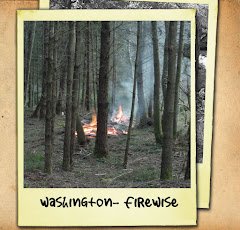
Be FireWise!
Firewise Course Information
Firewise Learning Center courses cover a range of wildfire safety topics for audiences including homeowners, forestry professionals, and firefighters. Course design and length varies, but all courses are structured to allow you to learn at your own pace.
Once you have enrolled in a course, you can return to the Firewise Learning Center at any time to continue a course you have started or take a new course.
Courses:
Firewise Landscaping is designed for people living in wildland areas who make decisions about landscaping their homes. The course considers the issues of appropriate landscape designs, specific planting and pruning alternatives, and appropriate planting materials for interface/intermix fire environments.
It has three parts: an Overview; Design/Installation; and Maintenance. It also includes a virtual Firewise landscaping model you can use to visualize design alternatives. The course takes approximately three hours to complete.
Firefighter Safety in the Wildland/Urban Interface addresses problems faced by structural and wildland firefighters when fighting fires, especially those threatening structures in the wildland/urban interface. An important goal is to improve knowledge of firefighter safety and survival issues.
The course has three parts: Understanding Fire Behavior in the WUI; Structure Protection Strategies in the WUI; and Firefighter Safety in the WUI. The entire course takes approximately four hours to complete.
Water Training is a comprehensive guide to using water effectively during firefighting operations in the wildland/urban interface. It is intended for all firefighters and provides the learner with important information and relevant examples to help develop strategies to use water in the most effective manner. The course takes approximately four hours to complete.
See the Firewise Link on the rightside of the blog.
Enroll in a course now. www.firewise.org
Monday, June 28, 2010
Fireworks Safety
Fireworks Sales Begin June 28th
Personal Fireworks Require Personal Responsibility
Personal Fireworks Require Personal Responsibility
State Fire Marshal Charles M. Duffy announced, with retail fireworks stands opening across the state on June 28th, everyone is reminded that, “Personal fireworks require personal responsibility.”
In 2009, 1,236 fireworks incidents were reported to the State Fire Marshal’s Office, with 30% of these incidents having no adult supervision. This included 200 injuries, of which 66 were children under the age of 14. “There is much that can be done to protect children and others from fireworks injuries,” says Duffy who offers the following, “First, set family boundaries, only adults should light fireworks. Supervision is paramount in keeping children safe. Second, fireworks should not be readily available to tempt the curiosity of young children, and should be stored in a secured location to prohibit their access. Third, check with your local fire or police department for additional restrictions in your area. Most importantly, talk about safety. Summer weather conditions make grass and other vegetation dry and vulnerable to fire. Use care in selecting the area where you will be discharging fireworks.”
Don’t take any chances; be sure the fireworks you purchase are legal to possess and discharge. Know the dates and times fireworks are allowed in your community. Stay away from high powered illegal explosive devices such as M80’s and M100’s. The damage they cause can be devastating, life altering, and even result in death.
Remember the three B’s of fireworks safety:
Be Prepared—Have water nearby and put pets indoors,
Be Safe—Only adults should light fireworks, and
Be Responsible—clean up fireworks debris.
Attending a public display is a safe and fun way to enjoy fireworks. To learn about a community fireworks display near you, visit our website at http://www.wsp.wa.gov/fire/fireworks.htm. For more information contact your local fire department, or the Office of the State Fire Marshal at (360) 596-3916.
Thursday, June 24, 2010
Burn Ban Information
Outdoor Burn Bans
Fire season is here and as temperatures rise, many counties and fire agencies have instituted burn bans. These bans can prohibit everything from burning yard waste to a campfire. In Washington, a burn ban violation is punishable by a fine of up to $10,000. “Outdoor fires that get out of control can cause large wildfires that put citizens, firefighters and property at risk,” says State Fire Marshal Charles Duffy. You may also be responsible for the cost of putting out the fire as well as any damaged property.
To better understand a burn ban, residents should familiarize themselves with the following types of outdoor fires –
Agricultural Burning: The burning of vegetative debris from an agricultural operation necessary for disease or pest control, for crop propagation and/or crop rotation, or where identified as the best management practice by the agricultural burning practices and research task force established in RCW 70.94.650 or other authoritative source on agricultural practices.
Ceremonial Fire: A fire built of dry wood for an organized function (e. g. Homecoming game, religious functions, etc)
Debris Disposal Fire: A fire for the elimination of a fire hazard and for the purpose of clean-up of natural vegetation and residue of a natural character such as leaves, clippings, trees, stumps, brush, shrubbery and wood so long as it has not been treated by an application of prohibited material or substance. There are established size limitations based on the time of year and the county within which the burning occurs.
Recreational Fire: A fire for the purpose of sport, pastime or refreshment in a hand-built pile no larger than four feet in diameter and not associated with any debris disposal activities related to fire hazard elimination or yard and garden refuse clean-up.
Silvicultural Burning: All burning on any land the Department of Natural Resources (DNR) protects, or on any forest lands administered by federal agencies or Indian nations.
Always check with your local fire department for permit and safety requirements before you light any outdoor fire. For more information, please visit the Office of State Fire Marshal website at www.wsp.wa.gov/fire/firemars Specific county burn ban information can be obtained at http://fortress.wa.gov/dnr/firedanger/BurnRisk.aspx or by calling 800-323-BURN.
Wednesday, June 23, 2010
Hazardous Weather Outlook
HAZARDOUS WEATHER OUTLOOK
NATIONAL WEATHER SERVICE PENDLETON OR
540 AM PDT WED JUN 23 2010
THIS HAZARDOUS WEATHER OUTLOOK IS FOR CENTRAL AND NORTHEAST OREGON
AS WELL AS SOUTH CENTRAL AND SOUTHEAST WASHINGTON.
.DAY ONE...TODAY AND TONIGHT
THUNDERSTORMS
EAST SLOPES OF THE CENTRAL CASCADES OF WASHINGTON, EAST SLOPES
OF THE SOUTHERN CASCADES OF WASHINGTON, EASTERN COLUMBIA RIVER
GORGE OF WASHINGTON, KITTITAS VALLEY, YAKIMA VALLEY, LOWER
COLUMBIA BASIN OF WASHINGTON, FOOTHILLS OF THE BLUE MOUNTAINS
OF WASHINGTON, NORTHWEST BLUE MOUNTAINS OF WASHINGTON, EASTERN
COLUMBIA RIVER GORGE OF OREGON, NORTH CENTRAL OREGON, CENTRAL
OREGON, LOWER COLUMBIA BASIN OF OREGON, GRANDE RONDE VALLEY,
WALLOWA COUNTY, FOOTHILLS OF THE BLUE MOUNTAINS OF OREGON,
NORTHERN BLUE MOUNTAINS OF OREGON, SOUTHERN BLUE MOUNTAINS OF
OREGON, NORTHERN WHEELER AND SOUTHERN GILLIAM COUNTIES, JOHN
DAY BASIN, OCHOCO-JOHN DAY HIGHLANDS
A WEAK DISTURBANCE WILL MOVE THROUGH THE REGION THIS MORNING. THIS
SYSTEM WILL BRING MOSTLY CLOUDY SKIES AND POTENTIALLY A SPRINKLE OR
TWO. AN UPPER TROUGH WILL MOVE ONSHORE THIS AFTERNOON AND TONIGHT.
THIS TROUGH WILL CAUSE THE AIR MASS TO DESTABILIZE IN THE AFTERNOON
ALLOWING FOR THE DEVELOPMENT OF SHOWERS AND THUNDERSTORMS OVER MUCH OF THE AREA. THESE STORMS MAY PRODUCE BRIEF HEAVY RAIN...SMALL HAIL
AND GUSTY WINDS. THE THUNDERSTORMS SHOULD END BY MIDNIGHT...BUT A
FEW SHOWERS MAY LINGER THROUGH THE NIGHT.
.DAYS TWO THROUGH SEVEN...THURSDAY THROUGH TUESDAY
THUNDERSTORMS THURSDAY
LOWER COLUMBIA BASIN OF WASHINGTON, FOOTHILLS OF THE BLUE
MOUNTAINS OF WASHINGTON, NORTHWEST BLUE MOUNTAINS OF
WASHINGTON, CENTRAL OREGON, LOWER COLUMBIA BASIN OF OREGON,
GRANDE RONDE VALLEY, WALLOWA COUNTY, FOOTHILLS OF THE BLUE
MOUNTAINS OF OREGON, NORTHERN BLUE MOUNTAINS OF OREGON,
SOUTHERN BLUE MOUNTAINS OF OREGON, NORTHERN WHEELER AND
SOUTHERN GILLIAM COUNTIES, JOHN DAY BASIN, OCHOCO-JOHN DAY
HIGHLANDS
THE UPPER TROUGH WILL WEAKEN THURSDAY INTO FRIDAY. THIS WILL ALLOW
FOR GRADUALLY INCREASING ONSHORE FLOW. THERE SHOULD BE ENOUGH
INSTABILITY THURSDAY FOR MORE SHOWERS AND THUNDERSTORMS...THOUGH
THIS THREAT SHOULD BE LIMITED IN CENTRAL WASHINGTON AND CENTRAL
OREGON. THE BEST CHANCES FOR THUNDERSTORMS WILL BE OVER THE EXTREME
NORTHEAST OREGON THURSDAY. THE COVERAGE OF SHOWERS AND THE THREAT OF THUNDERSTORMS WILL DIMINISH FURTHER ON FRIDAY. WEAK HIGH PRESSURE SHOULD BRING DRIER AND WARMER CONDITIONS TO THE REGION THIS WEEKEND. ANOTHER DEEP PACIFIC LOW PRESSURE SYSTEM LOOKS TO PUSH A COLD FRONT INTO THE REGION EARLY NEXT WEEK.
.SPOTTER INFORMATION STATEMENT...
SPOTTER ACTIVATION MAY BE REQUIRED.
WEATHER SPOTTERS ARE ENCOURAGED TO REPORT SIGNIFICANT WEATHER
CONDITIONS ACCORDING TO STANDARD OPERATING PROCEDURES.
GRAPHICAL FORECASTS OF WEATHER HAZARDS OUT TO SEVEN DAYS
ARE DISPLAYED ON THE WORLD WIDE WEB AT:
WWW.WRH.NOAA.GOV/PDT/CURRENTHAZARDS/HWO.HTML
Monday, June 21, 2010
It's Boating Time!
Safe Boating
“With boating season in full swing, it is important to observe and practice safety afloat. We are offering these boating safety tips, hoping you will have many fun and safe boating experiences,” says State Fire Marshal Charles M. Duffy.
1. Leave Alcohol on Shore: In 2008, alcohol was either a direct or indirect contributing factor in 35 percent of all boating fatalities.
2. Take a Boating Safety Course: More than 70 percent of all reported boating fatalities in 2007 occurred on boats where the operator had not completed a boating safety course. You may even qualify for a reduced insurance rate if you complete a safety course. Contact your local Coast Guard Auxiliary, U.S. Power Squadron chapter or visit www.uscg.mil for more information on courses in your area.
3. File a Float Plan: The U.S. Coast Guard recommends that you always tell a friend or family member where you plan to go and when you will return. Make it a habit before leaving on any boat trip. The proper officials can be notified promptly if you don’t return when expected.
4. Be Weather-Wise: A calm day can quickly turn ugly on the water. Keep an eye out for changing weather conditions and stay on top of the forecast while boating. Promptly heed all weather and storm advisories.
5. Use and Maintain the Right Safety Equipment:
a. Life Jackets and Personal Flotation Devices - State law requires each person on board to have a properly-fitting U.S. Coast Guard approved serviceable life jacket. Also, boats longer than 16 feet must have a throwable Personal Flotation Device.
b. Fire Extinguishers - If your boat has any enclosed compartments or a false floor, you must carry a Coast Guard approved fire extinguisher. Make sure it is charged and accessible.
c. Boat Lights - Always test your boat lights before the boat leaves the dock and carry extra batteries.
d. Emergency Supplies - Keep on board in a floating pouch: maps, flares, and a first aid kit.
e. Anchor - Make sure you have one and can properly use it. Improper anchoring may cause fatal accidents.
6. Designate an Assistant Skipper: Make sure more than one person on board is familiar with all aspects of your boat’s handling, operations, and other boating safety tips. If the primary navigator is injured or incapacitated in any way, it’s important to make sure someone else can follow the proper boating safety rules to get everyone back to shore.
More information on boating safety is available at Boat-ed.com or Boater101.com
Thursday, June 3, 2010
Flood Watch
- IMMEDIATE BROADCAST REQUESTED
FLOOD WATCH
NATIONAL WEATHER SERVICE PENDLETON OR 1215 PM PDT THU JUN 3 2010
ANOTHER ROUND OF HEAVY RAIN WILL SPREAD OVER THE REGION TONIGHT AND FRIDAY WITH FLOODING POSSIBLE.
GRANDE RONDE VALLEY-WALLOWA COUNTY-FOOTHILLS OF THE BLUE MOUNTAINS OF OREGON-NORTHERN BLUE MOUNTAINS OF OREGON-FOOTHILLS OF THE BLUE MOUNTAINS OF WASHINGTON-NORTHWEST BLUE MOUNTAINS OF WASHINGTON-INCLUDING THE CITIES OF LA GRANDE, ELGIN, UNION, ENTERPRISE, JOSEPH WALLOWA, HEPPNER, PENDLETON, MEACHAM, TOLLGATE, DAYTON, WAITSBURG,
WALLA WALLA
1215 PM PDT THU JUN 3 2010
THE NATIONAL WEATHER SERVICE IN PENDLETON HAS ISSUED A* FLOOD WATCH FROM MIDNIGHT PDT TONIGHT THROUGH FRIDAY EVENING*
RAINFALL AMOUNTS OF 0.75 TO 1.50 INCHES ARE EXPECTED TO FALL BETWEEN MIDNIGHT TONIGHT AND LATE DAY FRIDAY. THIS HEAVY RAIN ON TOP OF ALREADY SATURATED SOILS WILL CAUSE RAPID RUNOFF AND MAY CAUSE AREAS OF FLOODING ALONG CREEKS AND STREAMS. THERE IS A POTENTIAL FOR MUDSLIDES...DEBRIS FLOWS AND STREAM FLOODING IN THE MOUNTAINS OR AREAS OF STEEP TERRAIN.
PRECAUTIONARY/PREPAREDNESS ACTIONS...
A FLOOD WATCH MEANS THERE IS A POTENTIAL FOR FLOODING BASED ONCURRENT FORECASTS. YOU SHOULD MONITOR LATER FORECASTS AND BE ALERT FOR POSSIBLE FLOOD WARNINGS. THOSE LIVING IN AREAS PRONE TO FLOODING SHOULD BE PREPARED TO TAKE ACTION SHOULD FLOODINGDEVELOP. FOR ADDITIONAL WEATHER INFORMATION...CHECK THE WEBSITE AT WWW.WEATHER.GOV/PENDLETON.
FLOOD WATCH
NATIONAL WEATHER SERVICE PENDLETON OR 1215 PM PDT THU JUN 3 2010
ANOTHER ROUND OF HEAVY RAIN WILL SPREAD OVER THE REGION TONIGHT AND FRIDAY WITH FLOODING POSSIBLE.
GRANDE RONDE VALLEY-WALLOWA COUNTY-FOOTHILLS OF THE BLUE MOUNTAINS OF OREGON-NORTHERN BLUE MOUNTAINS OF OREGON-FOOTHILLS OF THE BLUE MOUNTAINS OF WASHINGTON-NORTHWEST BLUE MOUNTAINS OF WASHINGTON-INCLUDING THE CITIES OF LA GRANDE, ELGIN, UNION, ENTERPRISE, JOSEPH WALLOWA, HEPPNER, PENDLETON, MEACHAM, TOLLGATE, DAYTON, WAITSBURG,
WALLA WALLA
1215 PM PDT THU JUN 3 2010
THE NATIONAL WEATHER SERVICE IN PENDLETON HAS ISSUED A* FLOOD WATCH FROM MIDNIGHT PDT TONIGHT THROUGH FRIDAY EVENING*
RAINFALL AMOUNTS OF 0.75 TO 1.50 INCHES ARE EXPECTED TO FALL BETWEEN MIDNIGHT TONIGHT AND LATE DAY FRIDAY. THIS HEAVY RAIN ON TOP OF ALREADY SATURATED SOILS WILL CAUSE RAPID RUNOFF AND MAY CAUSE AREAS OF FLOODING ALONG CREEKS AND STREAMS. THERE IS A POTENTIAL FOR MUDSLIDES...DEBRIS FLOWS AND STREAM FLOODING IN THE MOUNTAINS OR AREAS OF STEEP TERRAIN.
PRECAUTIONARY/PREPAREDNESS ACTIONS...
A FLOOD WATCH MEANS THERE IS A POTENTIAL FOR FLOODING BASED ONCURRENT FORECASTS. YOU SHOULD MONITOR LATER FORECASTS AND BE ALERT FOR POSSIBLE FLOOD WARNINGS. THOSE LIVING IN AREAS PRONE TO FLOODING SHOULD BE PREPARED TO TAKE ACTION SHOULD FLOODINGDEVELOP. FOR ADDITIONAL WEATHER INFORMATION...CHECK THE WEBSITE AT WWW.WEATHER.GOV/PENDLETON.
Wednesday, June 2, 2010
Flood Advisory
FLOOD ADVISORY NATIONAL WEATHER SERVICE PENDLETON OR 333 PM PDT WED JUN 2, 2010
THE NATIONAL WEATHER SERVICE IN PENDLETON HAS ISSUED AN URBAN AND SMALL STREAM FLOOD ADVISORY FOR... NORTHERN UMATILLA COUNTY IN NORTHEAST OREGON... THIS INCLUDES THE CITIES OF...PENDLETON...MILTON-FREEWATER... SOUTHWESTERN COLUMBIA COUNTY IN SOUTHEAST WASHINGTON... EASTERN WALLA WALLA COUNTY IN SOUTHEAST WASHINGTON... THIS INCLUDES THE CITIES OF...WALLA WALLA...COLLEGE PLACE...* UNTIL 730 PM PDT* AT 327 PM PDT...
BANDS OF VERY HEAVY RAIN WERE MOVING ALONG THE FOOTHILLS OF THE BLUE MOUNTAINS FROM PILOT ROCK OREGON NORTHEAST THROUGH DAYTON WASHINGTON.
PERIODS OF HEAVY RAIN WILL CONTINUE FOR THIS AREA OVER THE NEXT COUPLE OF HOURS. THIS WILL CAUSE SHARP RISES IN AREA STREAMS AND CREEKS AS WELL AS PONDING OF WATER ON ROADS. MUDSLIDES IN AREAS OF STEEP TERRAIN ARE ALSO POSSIBLE. PRECAUTIONARY/PREPAREDNESS ACTIONS...IN HILLY TERRAIN THERE ARE HUNDREDS OF LOW WATER CROSSINGS WHICH ARE POTENTIALLY DANGEROUS IN HEAVY RAIN.
DO NOT ATTEMPT TO TRAVEL ACROSS FLOODED ROADS. FIND ALTERNATE ROUTES. IT TAKES ONLY A FEW INCHES OF SWIFTLY FLOWING WATER TO CARRY VEHICLES AWAY.
THE NATIONAL WEATHER SERVICE IN PENDLETON HAS ISSUED AN URBAN AND SMALL STREAM FLOOD ADVISORY FOR... NORTHERN UMATILLA COUNTY IN NORTHEAST OREGON... THIS INCLUDES THE CITIES OF...PENDLETON...MILTON-FREEWATER... SOUTHWESTERN COLUMBIA COUNTY IN SOUTHEAST WASHINGTON... EASTERN WALLA WALLA COUNTY IN SOUTHEAST WASHINGTON... THIS INCLUDES THE CITIES OF...WALLA WALLA...COLLEGE PLACE...* UNTIL 730 PM PDT* AT 327 PM PDT...
BANDS OF VERY HEAVY RAIN WERE MOVING ALONG THE FOOTHILLS OF THE BLUE MOUNTAINS FROM PILOT ROCK OREGON NORTHEAST THROUGH DAYTON WASHINGTON.
PERIODS OF HEAVY RAIN WILL CONTINUE FOR THIS AREA OVER THE NEXT COUPLE OF HOURS. THIS WILL CAUSE SHARP RISES IN AREA STREAMS AND CREEKS AS WELL AS PONDING OF WATER ON ROADS. MUDSLIDES IN AREAS OF STEEP TERRAIN ARE ALSO POSSIBLE. PRECAUTIONARY/PREPAREDNESS ACTIONS...IN HILLY TERRAIN THERE ARE HUNDREDS OF LOW WATER CROSSINGS WHICH ARE POTENTIALLY DANGEROUS IN HEAVY RAIN.
DO NOT ATTEMPT TO TRAVEL ACROSS FLOODED ROADS. FIND ALTERNATE ROUTES. IT TAKES ONLY A FEW INCHES OF SWIFTLY FLOWING WATER TO CARRY VEHICLES AWAY.
Thursday, May 27, 2010
Columbia County Capability Assessment Workshop
Columbia County Emergency Management hosted their first annual Capability Assessment Workshop on Tuesday, May 25th, 2010 at the Seneca activity building in Dayton.
Darrell Ruby, Region 9 Coordinator for Homeland Security was the facilitator for the workshop.
Preparedness is everyone's responsibility. Knowledgeable, empowered individuals and communities can make choices that minimize the impact of emergencies and disasters. Local governments educate and prepare communities, mitigate risks, and provide first response and recovery assistance. Voluntary organizations and businesses aid these efforts. Regional partner governments and communities augment local resources when necessary. Because major events can exceed the normal operating capacity of any single discipline, a collaborative, multi-discipline approach is needed to plan and prepare for major events.
The assessment was the first step in the annual preparedness cycle: assess capabilities, identify gaps and priorities, update strategic and multi-year plans, invest to fill gaps, and reassess capabilities.
The information gathered at the workshop will be compiled and shared with Region 9 Homeland Security Counties (Adams, Asotin, Columbia, Ferry, Garfield, Lincoln, Pend Oreille, Spokane, Stevens, Whitman and the Kalispell and Spokane Tribes). This information will serve as a guide for identifying and prioritizing investments when working to establish a capability. It will also help implement appropriate hazard mitigation strategies, and prepare for hazards and emergencies individual counties cannot mitigate on their own in order to have an effective response and recovery system in place.
In attendance were a well rounded group of multi-discipline stakeholders from throughout the County. Such stakeholders included, Columbia County Extension Agent, Columbia REA, Puget Sound Energy, Chamber of Commerce, Columbia County Fire District 1 and 3, Columbia County EMS, Columbia County Sheriff's Office and Communications, Blue Mountain chapter of the Red Cross, Columbia County Engineer and Public Works, Columbia County Transportation, Columbia County Public Health, Washington Department of Transportation and Mayor's from the City of Dayton and the Town of Starbuck.
The information provided to us from this group was invaluable. They are an integral resource to Emergency Management and Columbia County as a whole. When you see someone from any of the entities mentioned above tell them thank you for participating in making our community a safer place to live.
Darrell Ruby, Region 9 Coordinator for Homeland Security was the facilitator for the workshop.
Preparedness is everyone's responsibility. Knowledgeable, empowered individuals and communities can make choices that minimize the impact of emergencies and disasters. Local governments educate and prepare communities, mitigate risks, and provide first response and recovery assistance. Voluntary organizations and businesses aid these efforts. Regional partner governments and communities augment local resources when necessary. Because major events can exceed the normal operating capacity of any single discipline, a collaborative, multi-discipline approach is needed to plan and prepare for major events.
The assessment was the first step in the annual preparedness cycle: assess capabilities, identify gaps and priorities, update strategic and multi-year plans, invest to fill gaps, and reassess capabilities.
The information gathered at the workshop will be compiled and shared with Region 9 Homeland Security Counties (Adams, Asotin, Columbia, Ferry, Garfield, Lincoln, Pend Oreille, Spokane, Stevens, Whitman and the Kalispell and Spokane Tribes). This information will serve as a guide for identifying and prioritizing investments when working to establish a capability. It will also help implement appropriate hazard mitigation strategies, and prepare for hazards and emergencies individual counties cannot mitigate on their own in order to have an effective response and recovery system in place.
In attendance were a well rounded group of multi-discipline stakeholders from throughout the County. Such stakeholders included, Columbia County Extension Agent, Columbia REA, Puget Sound Energy, Chamber of Commerce, Columbia County Fire District 1 and 3, Columbia County EMS, Columbia County Sheriff's Office and Communications, Blue Mountain chapter of the Red Cross, Columbia County Engineer and Public Works, Columbia County Transportation, Columbia County Public Health, Washington Department of Transportation and Mayor's from the City of Dayton and the Town of Starbuck.
The information provided to us from this group was invaluable. They are an integral resource to Emergency Management and Columbia County as a whole. When you see someone from any of the entities mentioned above tell them thank you for participating in making our community a safer place to live.
Subscribe to:
Posts (Atom)




 Posts
Posts

